

Known for
Traditional freestyle polo, the summer Shandur Polo Festival and an open high-altitude lake-and-plateau landscape.
Private Shandur pass and festival journeys
A high-altitude plateau between Chitral and Ghizer: freestyle polo, open mountain landscapes and a seasonal crossing planned with care.
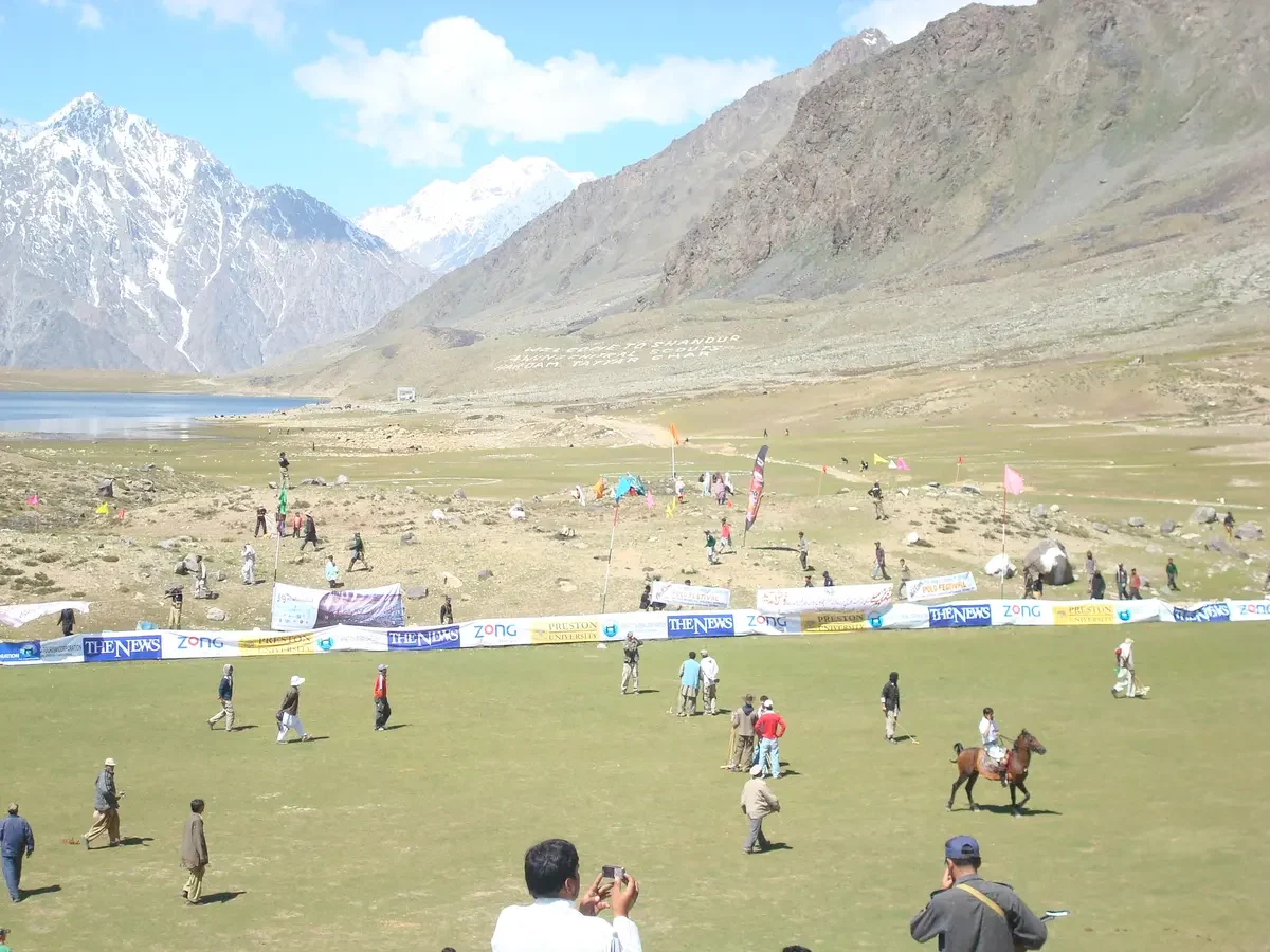
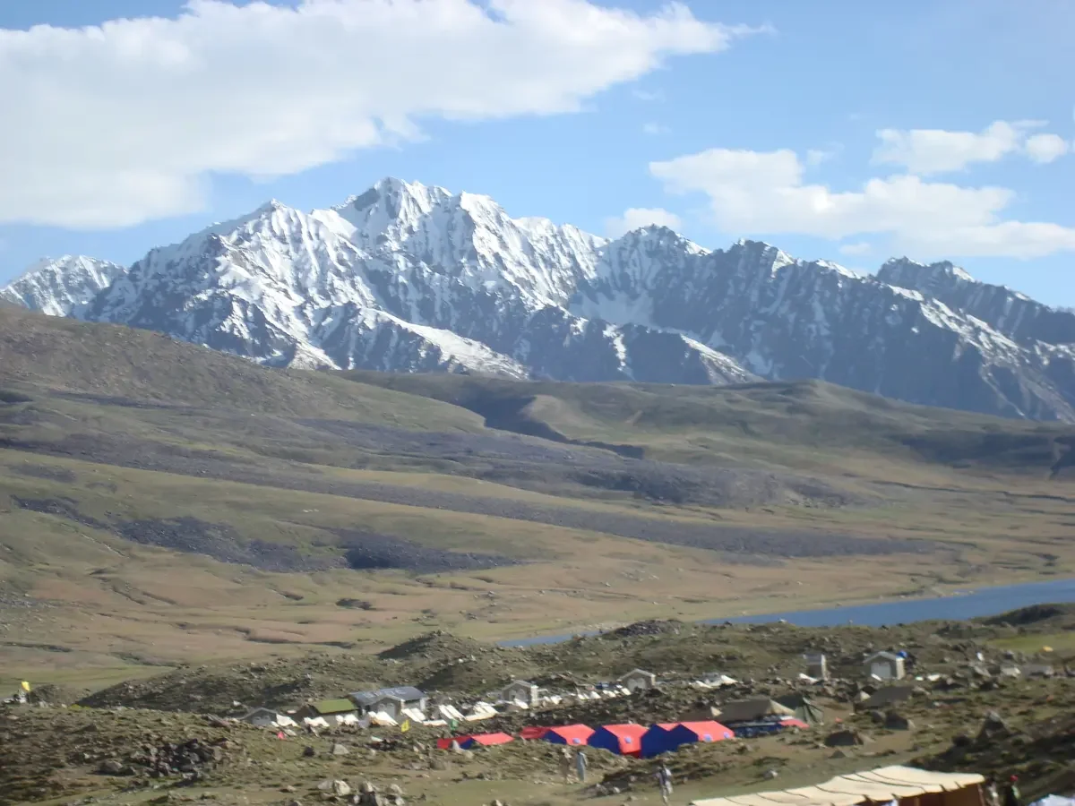
Shandur is a pass and open plateau linking Upper Chitral in Khyber Pakhtunkhwa with the Ghizer-side valleys of Gilgit-Baltistan. At roughly 3,700 metres, its lake, polo ground and mountain setting make it a distinctive stop on a cross-region journey rather than a town with year-round visitor services.
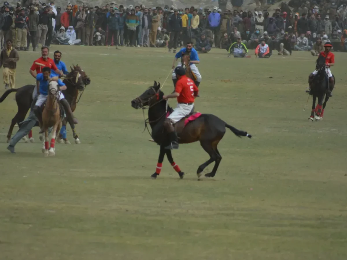
The festival brings traditional freestyle polo and regional cultural performances to this high ground. Outside festival days, the appeal is quieter: landscape photography, gentle walks and time beside the lake. Sylana plans the crossing around current road information, suitable transport and overnight stops rather than treating it as a guaranteed shortcut.
Choose the Shandur Polo Festival Private Tour for event-led travel, or the Kalash–Chitral–Shandur–Ghizer–Hunza Cultural Journey for a broader route. The Chitral and Ghizer guides explain the connected valley context.
Gallery photographs: Ijlalahmed (Shandur Polo 2016) and Epimelbonia (Shandur Polo Game / Ground), Wikimedia Commons, CC BY-SA 4.0. Existing images were resized, compressed and converted to WebP. Licence.
Places and character
Local context
Traditional freestyle polo, the summer Shandur Polo Festival and an open high-altitude lake-and-plateau landscape.
Plan meals with the route team. Confirm drinking water, dietary needs and food arrangements before a plateau stay; festival stalls should not be your only meal plan.
Walks and route ideas
A practical guide
Make Shandur the connecting moment between two valley journeys, not just a hurried photograph. Choose festival travel for polo and cultural atmosphere, or a quieter summer crossing for landscape time.
Festival polo brings teams and supporters from Chitral and Gilgit-Baltistan together, with music and cultural performances. Follow organisers' instructions, stay clear of players and horses, and ask before photographing people closely.
From Chitral, approach through Mastuj and Laspur. From Gilgit, travel through Gahkuch, Gupis and Phander toward the pass. Arrange the approach and onward stop as one route, with a driver familiar with current mountain-road conditions.
Arrange private driver-led transport suitable for the current surface and group luggage. Confirm whether a locally operated 4x4 section is needed; do not assume every vehicle can complete the crossing in every condition.
Shandur is a seasonal high crossing, not an all-year road promise. Winter snowfall closes access; snow clearance and weather determine reopening. Confirm local road reports shortly before departure and build an alternative valley route if the pass is unavailable.
Build in daylight and rest rather than chasing a fixed arrival time. Confirm camping, toilets, meals and water before staying on the plateau. Carry warm layers, sun protection and essential personal supplies; keep overnight arrangements flexible if weather deteriorates.
Ask before photographing residents or entering a camp or private space. Respect grazing areas, keep away from horses and the active polo field, and carry litter back out. Dress practically and respectfully; do not treat cultural performances as permission for intrusive photography.
Agree the ascent pace and overnight elevation before travelling with children or anyone concerned about altitude. Do not push through illness to keep an itinerary; stop ascending and seek local medical help if unwell. Remote camping is optional, not a requirement of the journey.
Seasonal context
Seasonal ranges are planning averages, not a forecast. Confirm current conditions and access close to travel. Shandur-specific historical station figures from the COMSATS-published temperature table, rounded across each season's months. These are historical planning guidance, not a current forecast or guaranteed daily limits; wind, snow and exposure can make conditions feel colder.
Typical seasonal range
Typical day: -1 to 11°C
Typical night: -12 to -1°C
March-May: cold thaw-season conditions; do not assume the road has opened.
Wear: Insulated layers, windproof shell, gloves and warm footwear.
Typical seasonal range
Typical day: 15 to 20°C
Typical night: 5 to 9°C
June-August: milder days, cool nights; access still needs confirmation.
Wear: Layered clothing, warm night jacket, rain shell and sun protection.
Typical seasonal range
Typical day: 1 to 15°C
Typical night: -9 to 4°C
September-November: rapid cooling; later-season snow can affect the crossing.
Wear: Thermal layers, insulated jacket, gloves and windproof outerwear.
Typical seasonal range
Typical day: -9 to -5°C
Typical night: -16 to -14°C
December-February: severe cold and snow; not a routine visitor crossing.
Wear: Full winter protection; clothing alone does not make a closed route safe.
The destination in detail
Travel further
Driver-led travel
Continue the journey
Common questions
Yes. We shape transport, pacing, stays and local coordination around your travel dates, group and preferred comfort level.
We confirm practical conditions for the season and the specific route. Mountain and regional travel can change quickly, so we build sensible flexibility into the plan.
Often, yes. The right combination depends on travel time, road logic and how much time you want to spend in each place.
Private Pakistan travel
Tell us your preferred pace, interests and travel window. We will help connect the right destinations, private transport and locally informed route planning.